
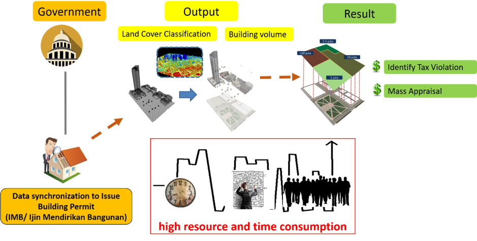
Building and land are considered to be important economical assets, as they could provide a form of income for the owners. Thus, knowing the value or market price of the building and land is very essential for the community. However, in Indonesia, the reality is that the price of the Nilai Jual Objek Pajak (Tax Object Market Value) or NJOP is very different from the actual market price. This problem occurred due to irregular update on the NJOP. The process of updating the NJOP requires a survey on the building or land, which requires time and cost. In addition, in Indonesia, the number of government-employed surveyors are limited. Therefore, there is a need for an alternative method on updating the NJOP.
An automated technology that can quickly estimate the value of land and buildings are a feasible alternative to address this problem. The potential to be able to create this automated technology can be found in LiDAR (Light Detection and Ranging) technology. LiDAR is able to provide a 3-dimensional imaging information, which can then be used to make accurate digital maps on a scale of 1: 10,000. This scale, when compared with existing online maps owned by the government, have a substantially higher accuracy.
With this high accuracy, information on estimated land prices/mass appraisal can be carried out more effectively. In addition to the accuracy of the land area classification, LIDAR can also provide information regarding the volume of buildings standing on the land. This information can be utilized to identify tax that should be paid based on the up-to-date volume. The output of this system is a software that detects building, measures land values, measures building values, and models 3D buildings automatically. The output will be synchronized with the Ijin Mendirikan Bangunan (Construction Permit) or IMB to Identify any Tax Violation and Mass or Land Appraisal.
By: Feasibility Study team